3d Model flythrough of a project under development
3D models provide accurate, up-to-date information on site quantities and project progress, allowing for better management, coordination, and decision-making.
Service Include
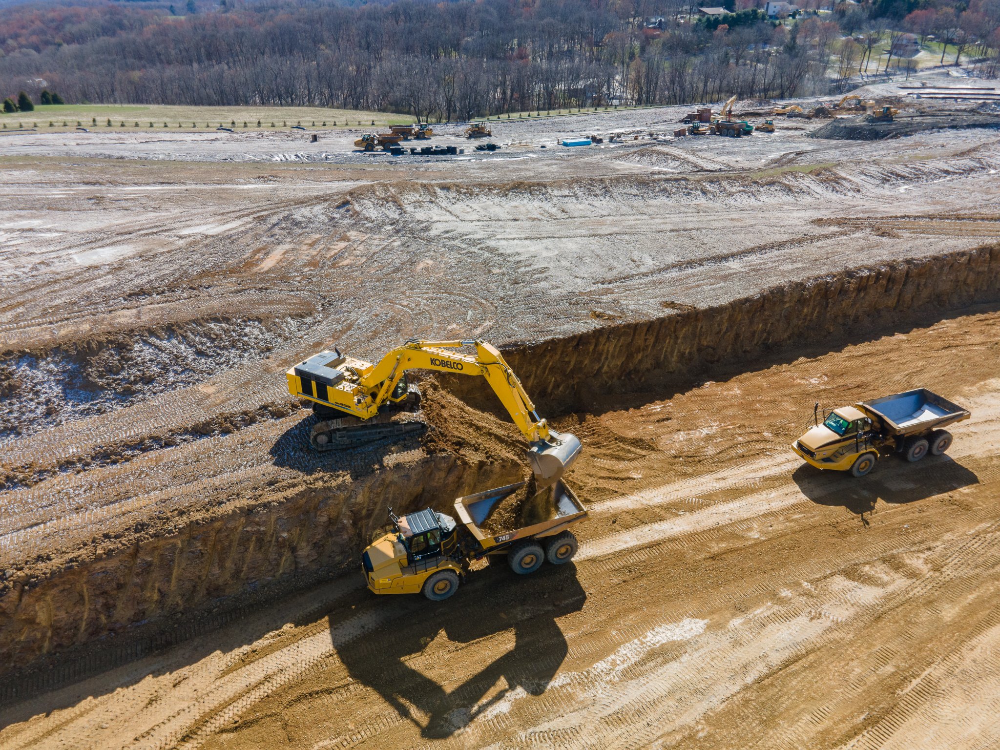
Construction Monitoring – High-resolution aerial mapping to track project progress, document site conditions, and support better project coordination.
3D Mapping & Modeling – Generate accurate orthomosaic maps, 3D surface models, and elevation data for planning, analysis, and reporting.
Earthwork & Volumetric Analysis – Measure stockpiles, cut/fill quantities, and grading progress with precise aerial data.
Site Documentation & Reporting – Capture detailed aerial imagery and data to provide clear records of project progress for stakeholders and project teams.
Aerial Photography & Video – Professional aerial imagery for project documentation, marketing, and visual progress updates.
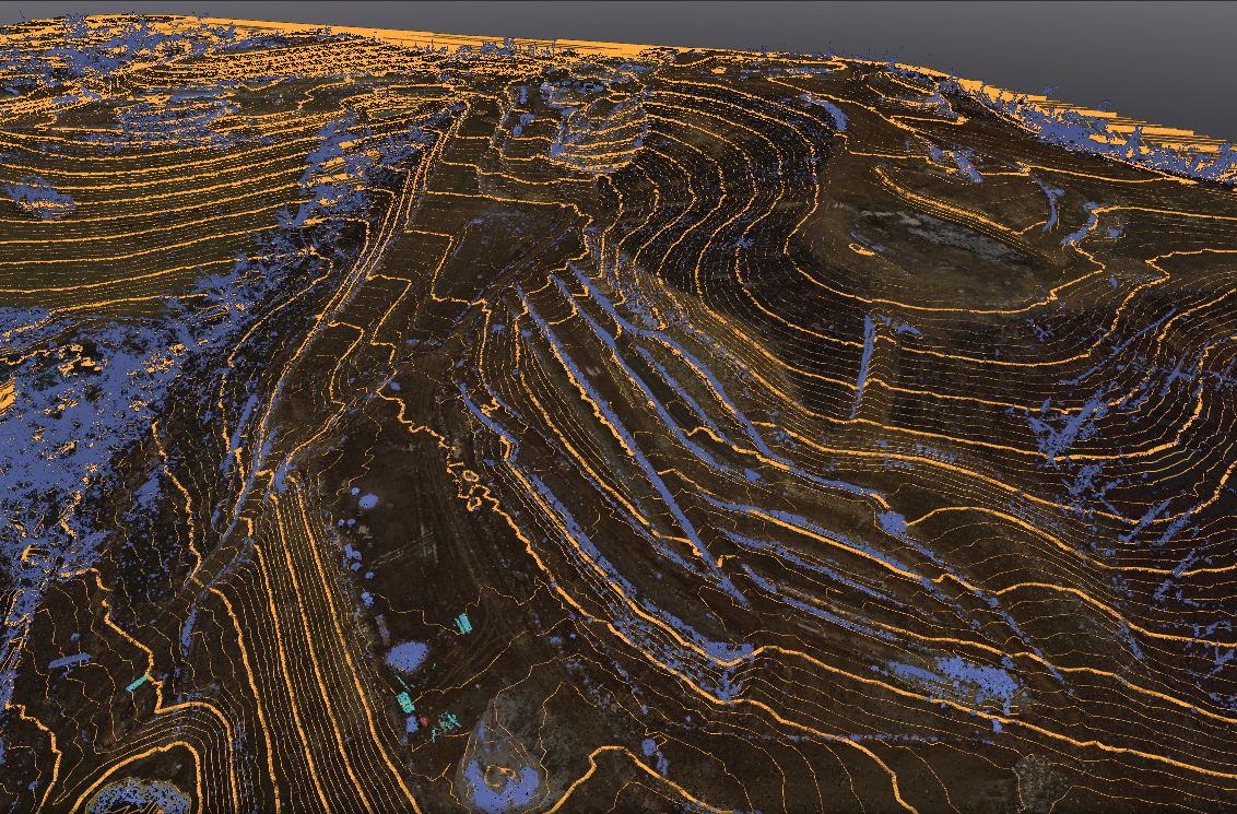
Existing Conditions Contour Lines
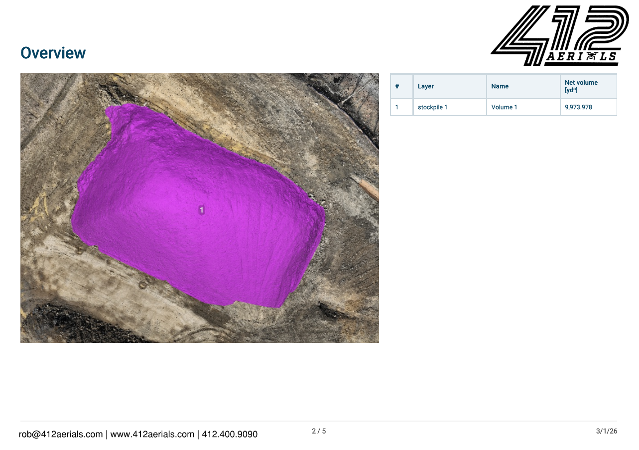
Stockpile quantity report
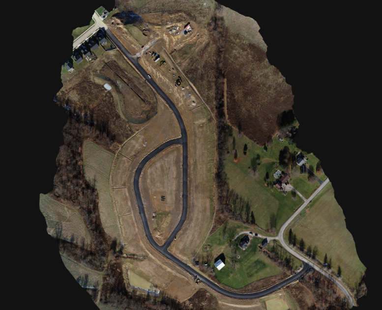
Orthomosiac image of a project located in Western Pennsylvania
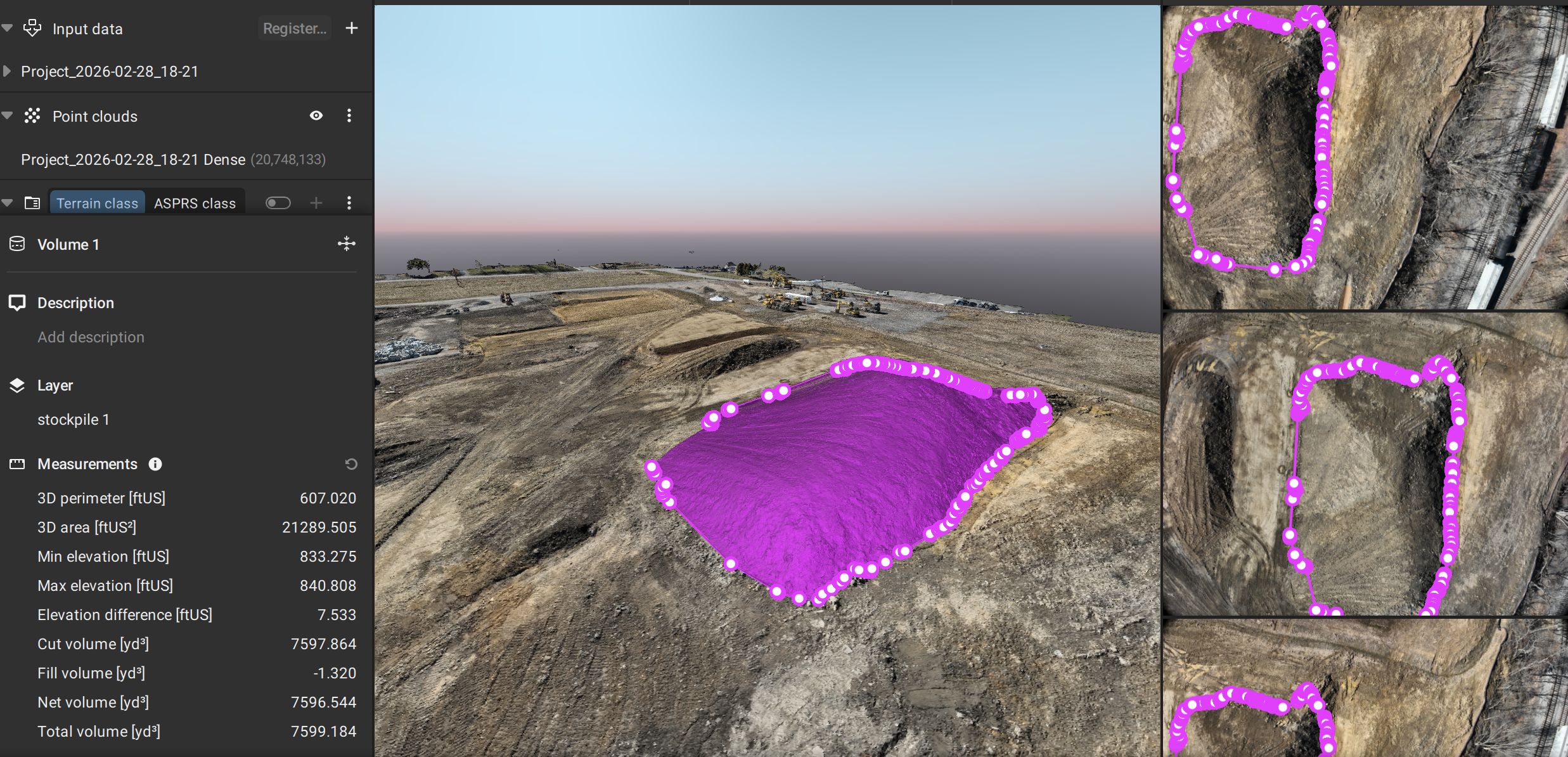
Stockpile quantity report
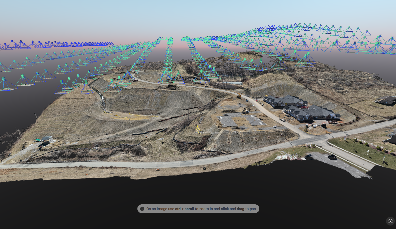
3D View of a project under construction in Wester Pennsylvania.
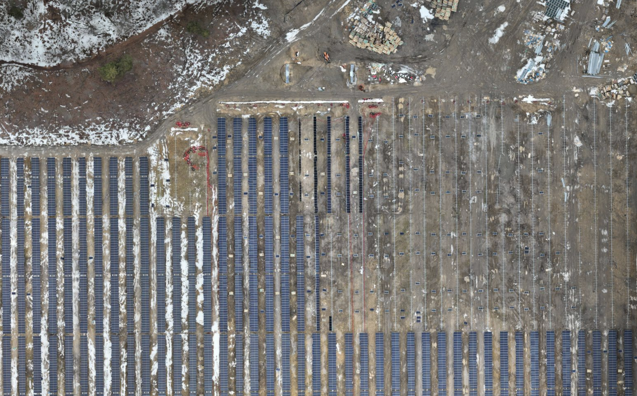
Progress mapping of a solar array in Pennsylvania